Filion Gold Project
Underexplored district-scale gold in Ontario's Archean greenstone belt
A 202 km² district-scale gold project along a 42 km deformation zone in one of the world's most productive Archean gold belts — largely underexplored, road-accessible, and open for discovery.
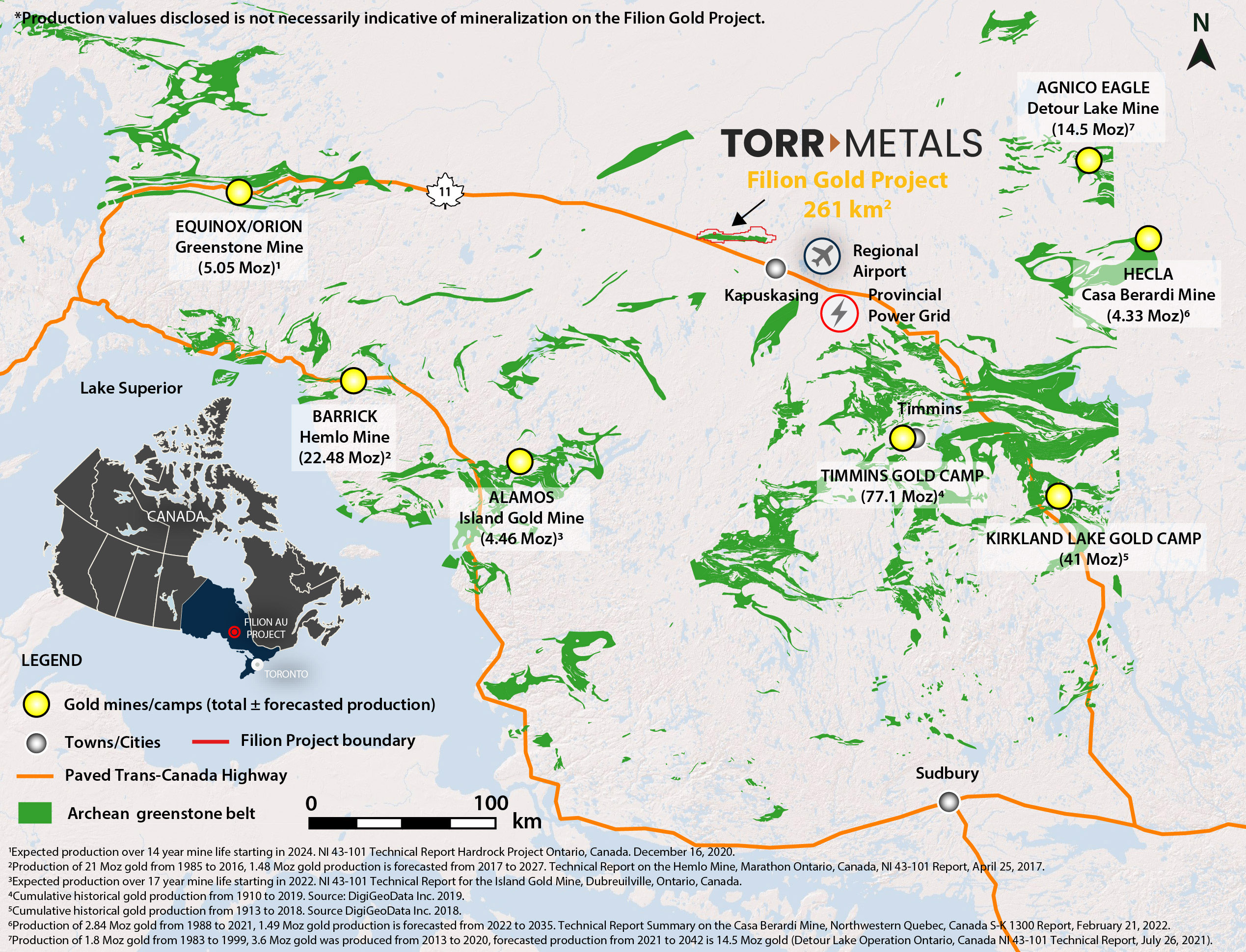
Located in the boundary region of the Wawa and Quetico geological subprovinces of Ontario, the 100%-owned Filion Project lies within a largely underexplored greenstone belt where gold was first discovered during the 1930s.
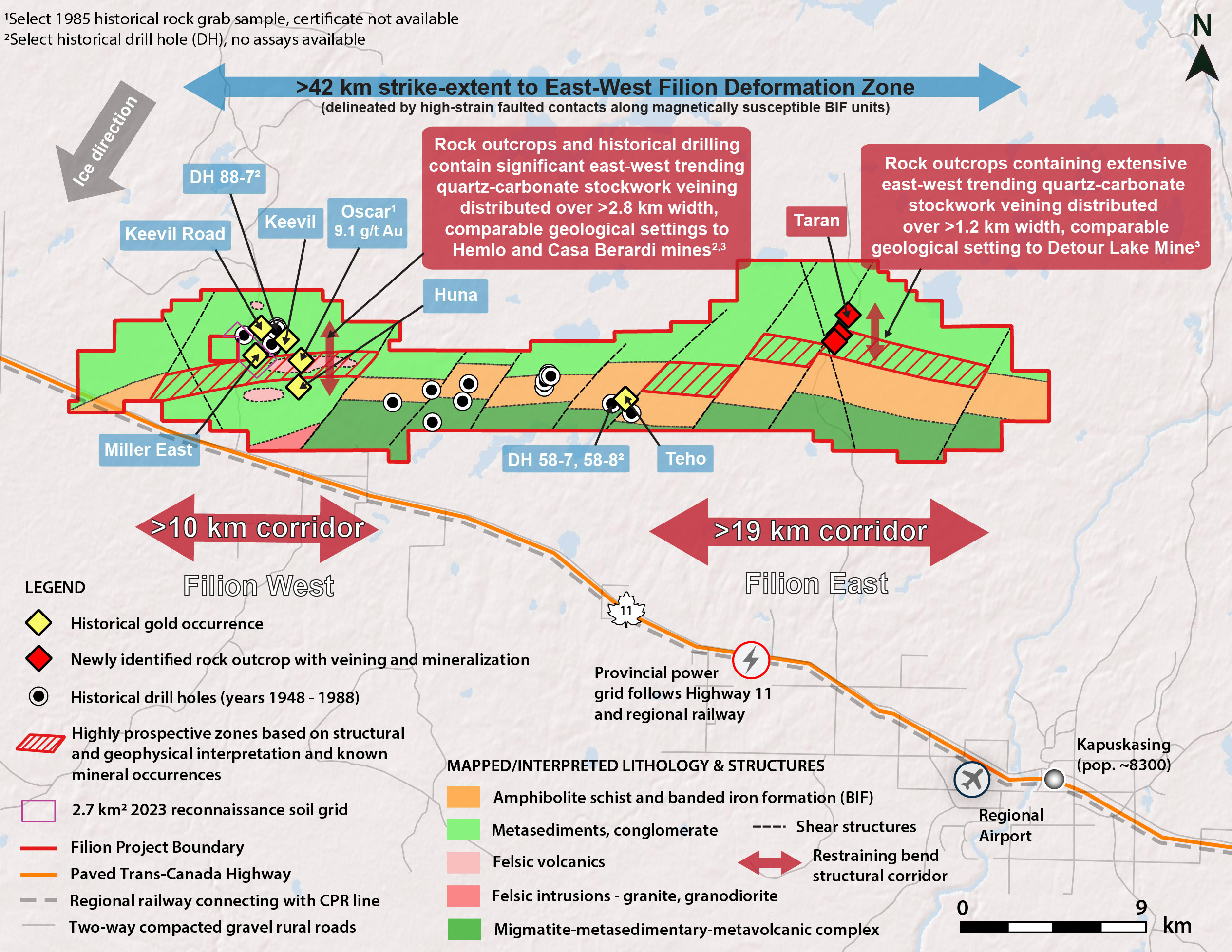
The project encompasses the major Filion Deformation Zone, which extends along a 42 km east-west trend — establishing a geological setting comparable to Archean gold deposits within the region including the Hemlo, Greenstone, Casa Berardi and Detour Lake mines.
The road-accessible project is ideally situated with excellent access to substantial infrastructure — the Trans-Canada Highway and a paralleling regional railway and power grid 4 km to the south, and the nearby town of Kapuskasing (pop. 8,300) — offering low-cost, year-round operation potential within a region ripe with new discovery potential.
Why Filion matters
Filion Deformation Zone
A 42 km east-west structural trend hosting the project — the same style of first-order structure that controls the region's multi-million-ounce gold camps.
High-Grade Gold
2025 rock-grab samples returned assays up to 13.1 g/t Au along a 140 m strike length within a ~900 m historically-trenched corridor.
Historic Occurrences
Gold in quartz veins with pyrite-arsenopyrite mineralization was discovered at the Oscar occurrence in the early 1930s; the Huna and Miller East occurrences followed with significant gold assays.
Underexplored Upside
Only ~8% of the district-scale package has been systematically explored. In 2023, Torr completed 318 humus soil samples (2.7 km²) and 83 outcrop channel samples.
The geological story
Filion straddles the Wawa–Quetico subprovince boundary within an Archean greenstone belt analogous to the Hemlo, Greenstone, Casa Berardi and Detour Lake gold systems.
The Trans-Canada Highway, regional rail and power grid lie 4 km south, with Kapuskasing (pop. 8,300) nearby — enabling low-cost, year-round work.